Planning Overview
OgImage:
Planning applications in Llanymynech: a village of two halves
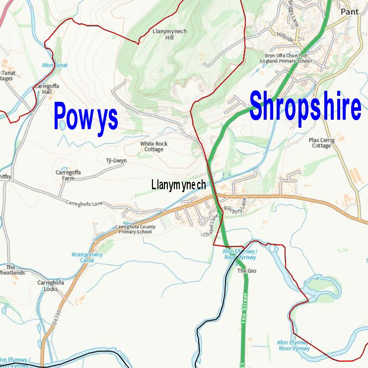
The village of Llanymynech straddles the border between Wales and England, outlined in red on the map (left). The planning authority for the Welsh part of the village (west of the red line) is Powys County Council, while Shropshire Council handles applications on the English side (east of the red line).
At the most local level, Carreghofa Community Council is a consultee for applications on the Welsh side of the boundary, and Llanymynech and Pant Parish Council is consulted on developments on the English side of the village.
Follow the links below to search for planning applications in the relevant area:
Where the border runs down the centre of the main road (A483) in Llanymynech, you may need to try both!